
Dados mostram aumento de mais de um terço no desmatamento da Amazônia no ano passado.
Ainda não há comentários. Deixe um comentário!
Posts relacionados
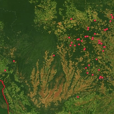
Deter 2013: os mapas do desmatamento na Amazônia
julho 11, 2013
Com base nas informações fornecidas pelo INPE , é possível visualizar quais os municípios, unidades de conservação e terras indígenas foram mais desmatadas.
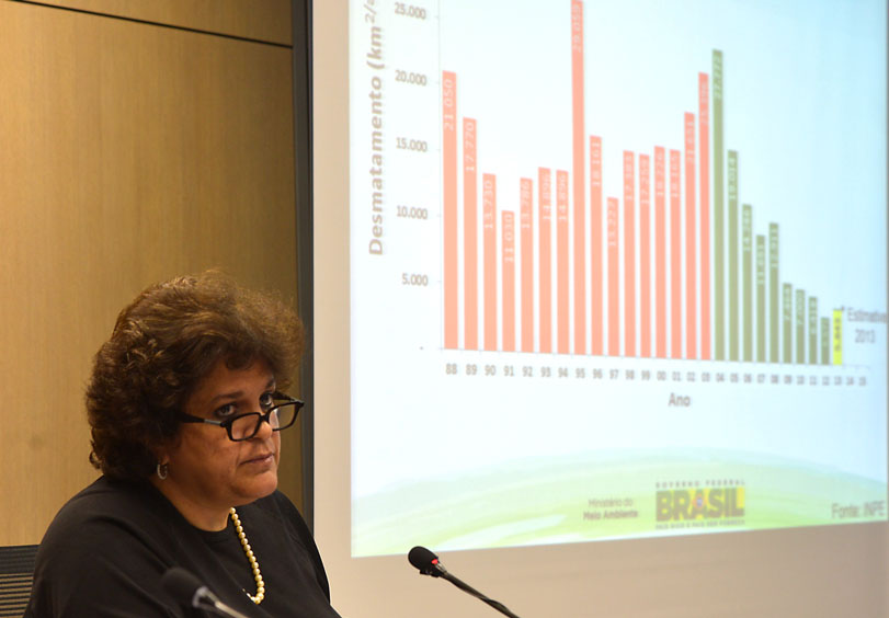
Zangada, ministra anuncia aumento de 28% no desmatamento
novembro 15, 2013
Izabella Teixeira relevou essa tarde que a Amazônia perdeu 5,8 mil km de floresta, quebrando uma série de 5 quedas consecutivas desde 2008.
Quatro décadas de desmatamento
junho 17, 2013
Desde 1969, aproximadamente 20% da floresta amazônica foi derrubada. Compare fotos de satélite e veja a Amazônia desaparecer diante de seus olhos.