
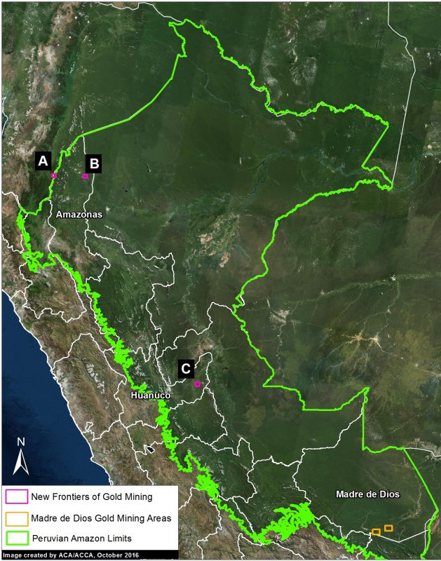
In the current report, we show the new gold mining frontiers in northern and central Peru: two cases in the region of Amazonas and a case in the buffer zone of El Sira Communal Reserve, in the Huanuco region.
Monitoring of the Andean Amazon Project
Early warnings of deforestation in the Peruvian Amazon
GLAD warning system identifies areas of forest loss analyzing Landsat satellite images (30 m resolution) weekly.
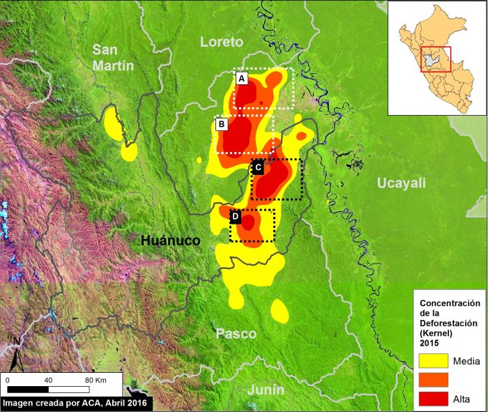
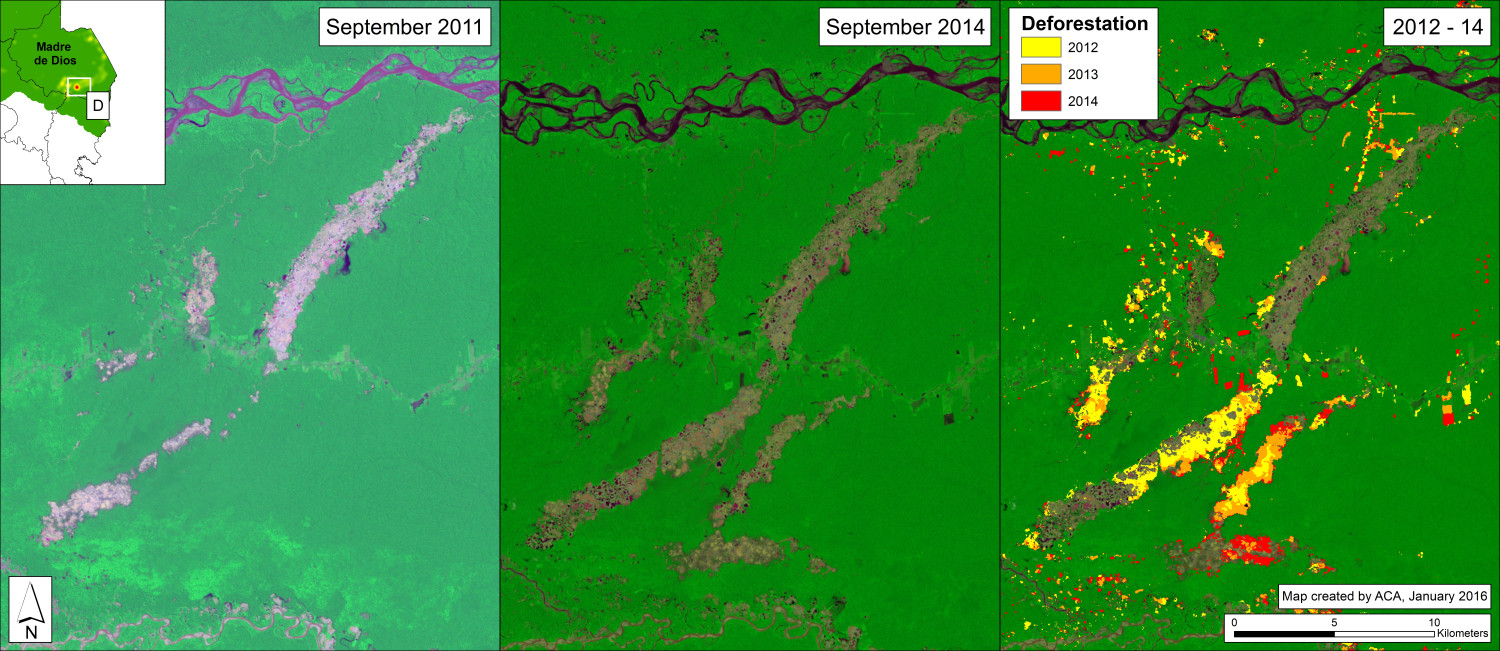
Hotspot of deforestation in the central jungle of Peru (Huanuco)
By 2015, deforestation was calculated at 7,930 hectares (equivalent to 10,865 football fields) in the study area. The main driver would be pasture for cattle.
MAAP: New gold mining border in Amazonas region, Peru
Satellite images confirm that mining is causing deforestation along river Santiago, entering the forests of the region.
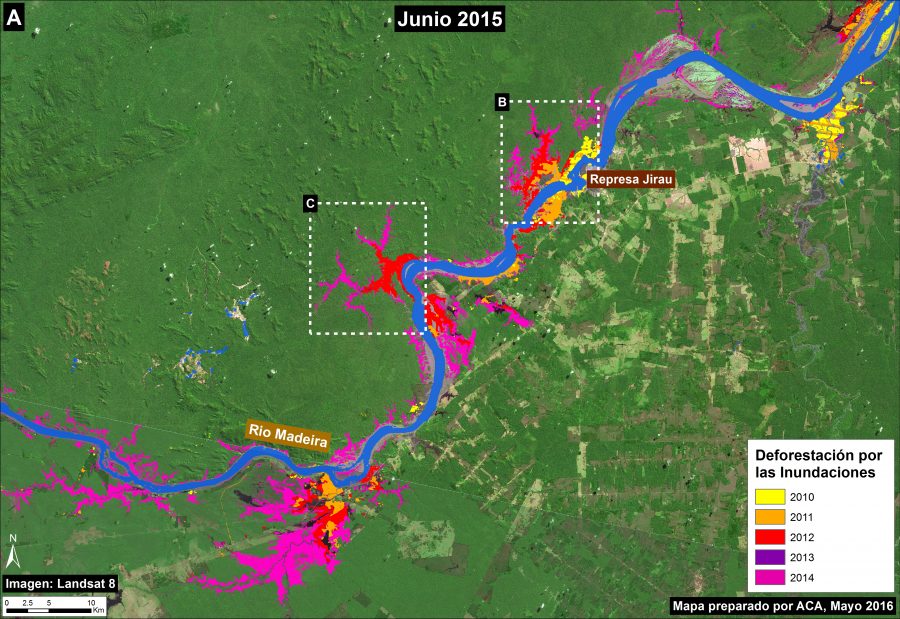
New dams on Madeira River floods cause deforestation
The Monitoring Andean Amazon Project presents a new map describing the loss of forest. More than 36,100 hectares of forest have been lost because of flooding by dams, especially the Jirau dam.
Map of deforestation hotspots in the Peruvian Amazon, 2012-2014
Deforestation continues to increase in the Peruvian Amazon. According to the latest information from the Peruvian Environment Ministry, 2014 had the highest annual forest loss on record since 2000.
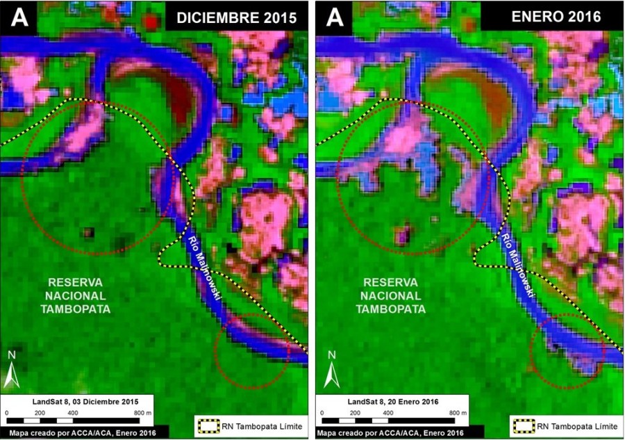
Illegal gold mining penetrates deeper into Tambopata National Reserve, Peru
MAAP shows two additional types of satellites imagery (due to lack of new high-resolution image) indicating that the illegal gold mining deforestation continues to penetrate deeper into the Reserve.
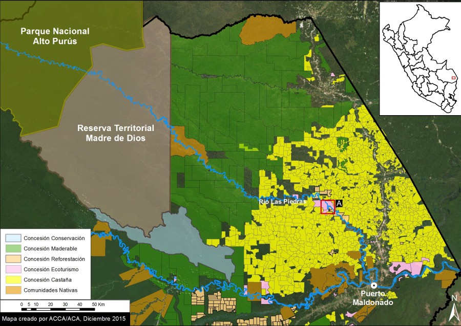
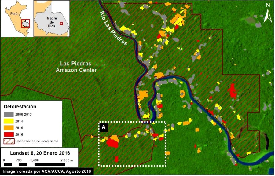
Increasing deforestation along lower Las Piedras River, Madre de Dios, Peru
The Las Piedras River, a major tributary of the Madre de Dios River in the southeast of the Peruvian Amazon, is increasingly being recognized for its exceptional wildlife, and by presence of indigenous peoples in voluntary isolation.
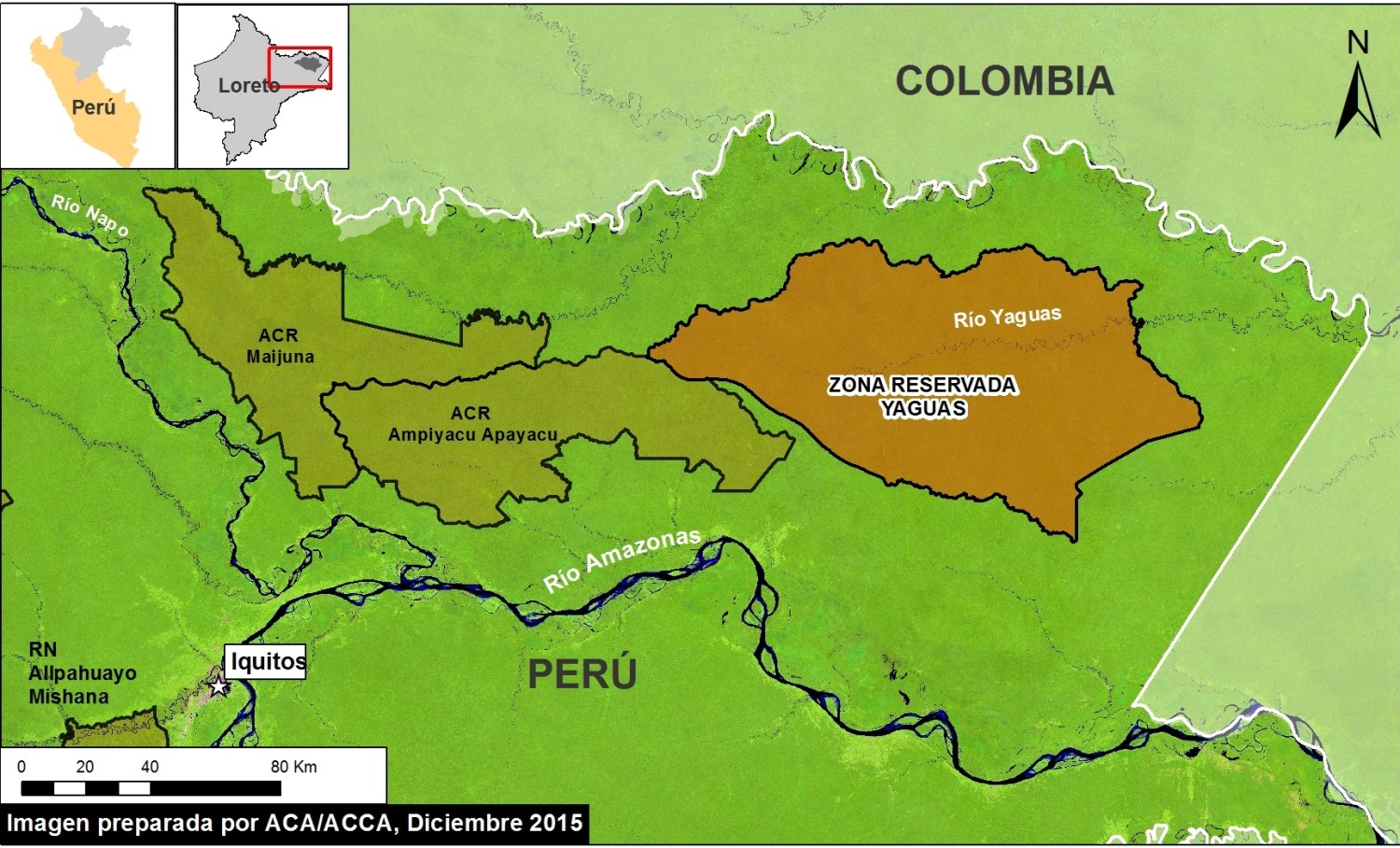
Yaguas – Another big conservation opportunity for Peru
In 2016, there is the opportunity for another major conservation victory in Peru: creation of Yaguas National Park. Yaguas received Reserved Zone status in 2011 and is now awaiting its final designation.
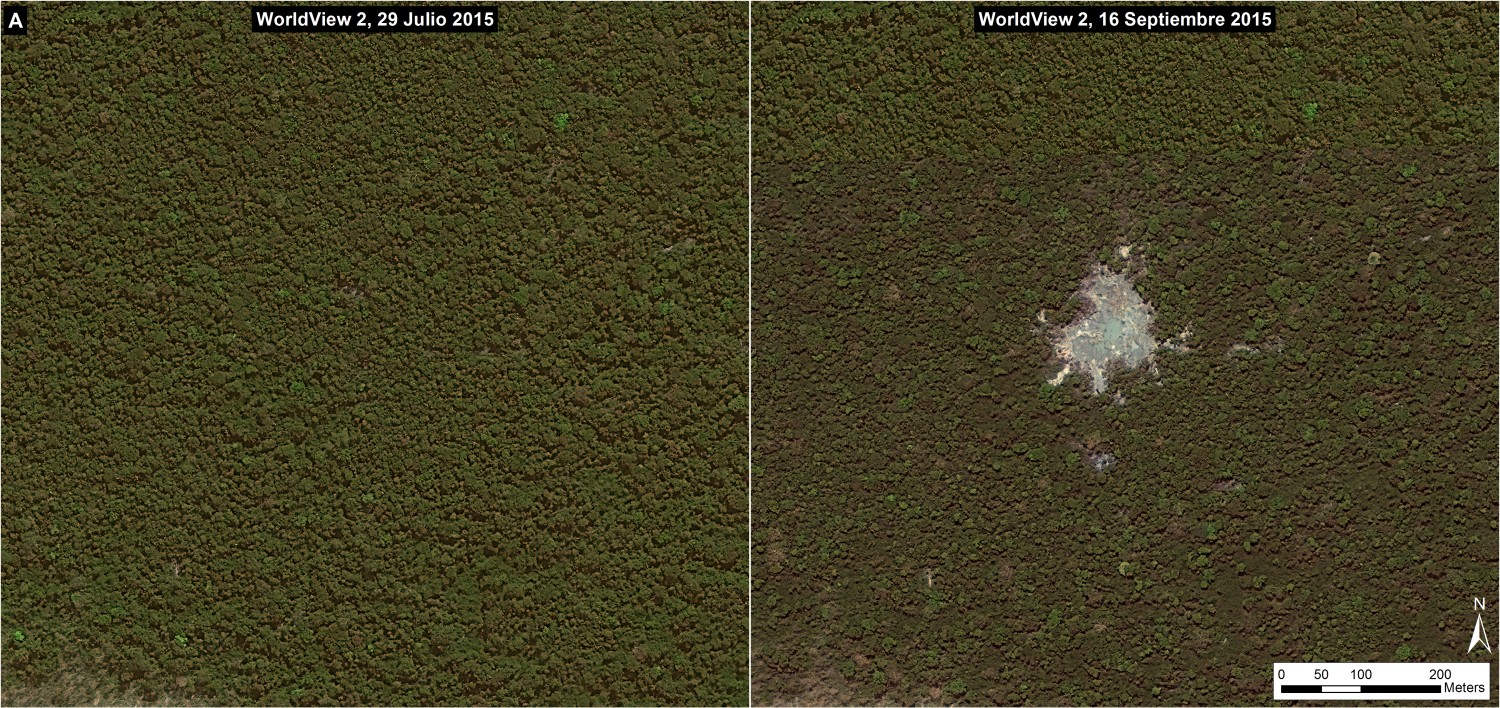
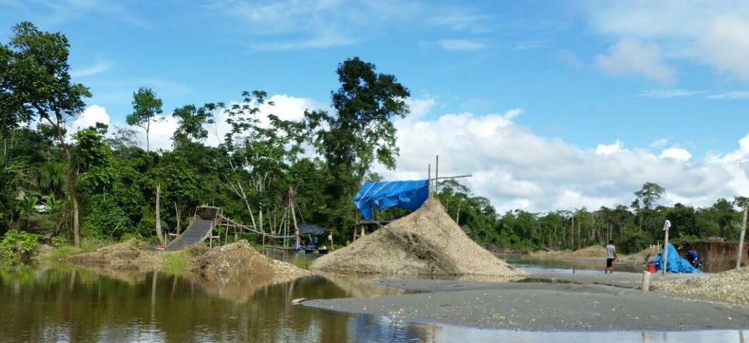
The birth of new area of illegal gold mining in Peru’s Amazon
New high resolution image of La Pampa of September 16, 2015 shows the birth of a new area of illegal gold mining, with a current area of 1.5 hectares.