
United Cacao Company has deforested 2,126 hectares of primary forest between May 2013 and August 2014. New image reveals that the deforestation has restarted at 2015, with 150 hectares missed during recent months.
Monitoring of the Andean Amazon Project
The Monitoring of the Andean Amazon Project (MAAP) is a web portal dedicated to presenting novel technical information and analysis pertaining to one of the most ecologically and socially important regions on the planet: the Andean Amazon (defined here as the sections of Bolivia, Colombia, Ecuador, and Peru within the Amazon watershed). The centerpiece of MAAP is the presentation of data and maps associated with a new near real-time deforestation monitoring system based on analysis of satellite imagery. O Projeto Monitoramento da Amazônia Andina (MAAP) é um site dedicado à apresentar novas informações técnicas e análises sobre uma das regiões mais importantes do mundo: a Amazônia Andina (aqui definida como seções da Bolívia, Colômbia, Equador e Peru na Bacia Amazônica). A peça central do MAAP é a apresentação de dados e mapas relacionados com um novo sistema de monitoramento do desmatamento em tempo quase real com base na análise de imagens de satélite. El Proyecto Monitoreo de la Amazonía Andina (MAAP) es un portal web dedicado a la presentación de información técnica novedosa y análisis sobre una de las regiones más importantes del planeta: la Amazonía Andina (definida aquí como las secciones de Bolivia, Colombia, Ecuador, y Perú dentro de la cuenca del Amazonas). La pieza central de MAAP es la presentación de datos y mapas relacionados con un nuevo sistema de monitoreo de la deforestación en tiempo casi real basado en el análisis de imágenes satelitales.
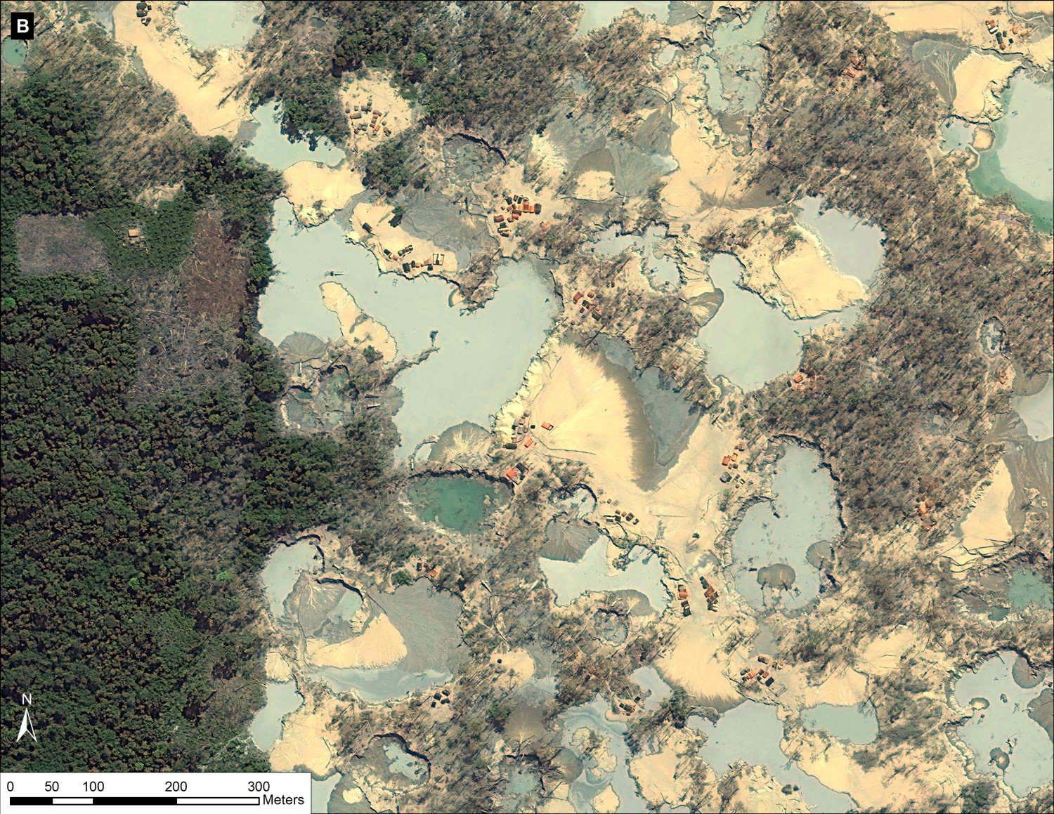
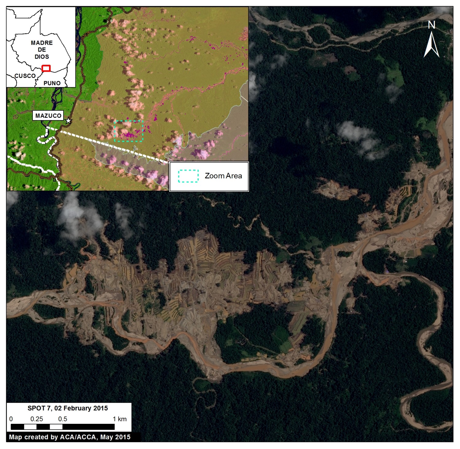
High-resolution view of illegal gold mining in La Pampa (Madre de Dios, Peru)
The images describe the expansion of deforestation by gold mining until February 2015 in the area known as La Pampa, located in the Madre de Dios region in the south of the Peruvian Amazon.
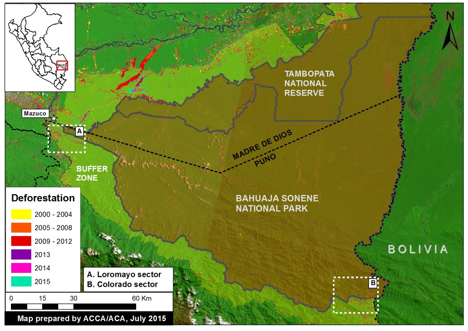
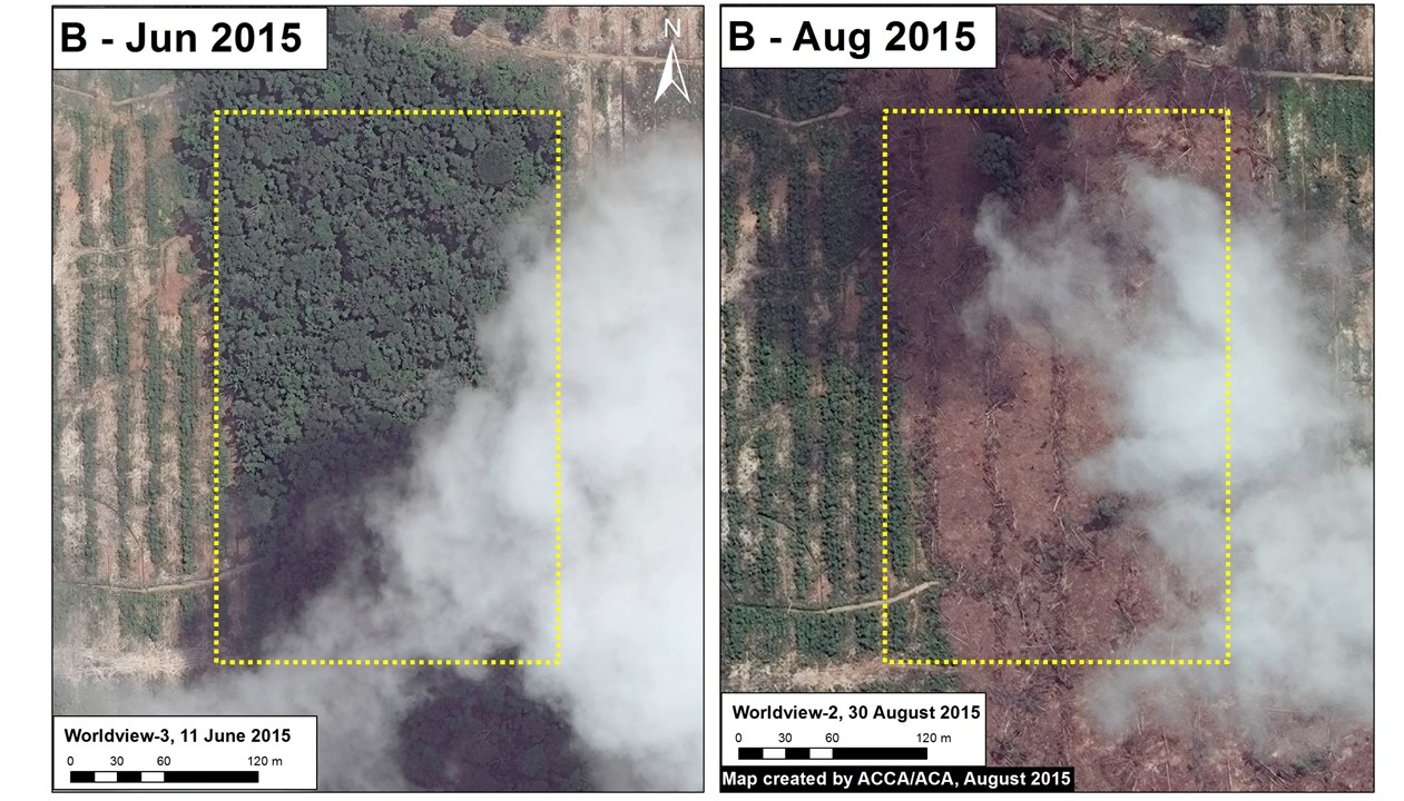
Bahuaja Sonene National Park – Increasing deforestation within and around Southern Section
MAAP found increasing deforestation in the buffer zone and inside the Park. Were documented recent deforestation of 538 hectares within the Park and an additional 2,100 hectares in the surrounding buffer zone.
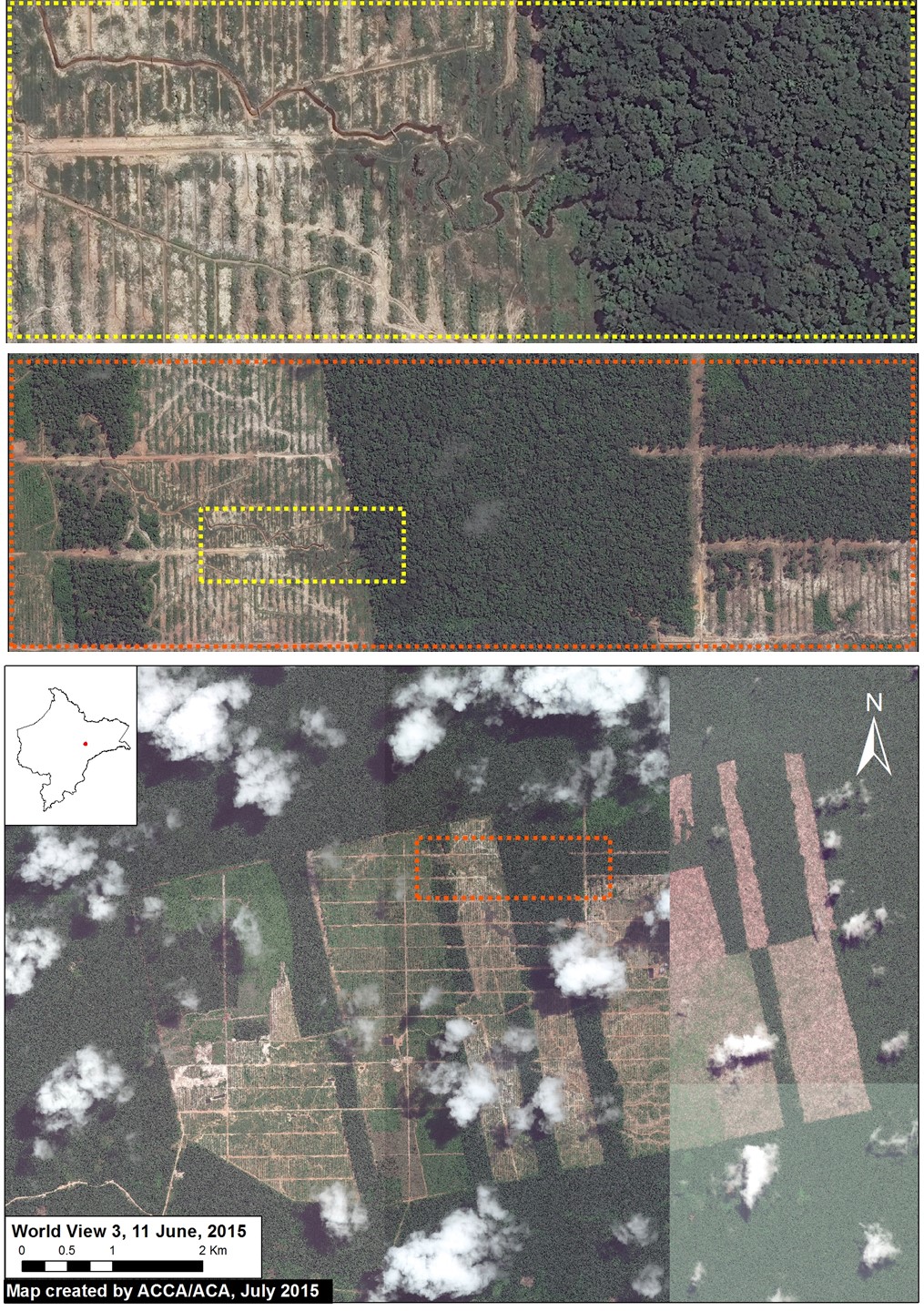
Satellite imagery confirm deforestation of primary forests in Tamshiyau, Peru
MAAP presents images of deforestation of 2,126 hectares of primary forest between May 2013 and August 2014, for cocoa plantations just outside Tamshiyacu, in northeastern Peru (Loreto region).
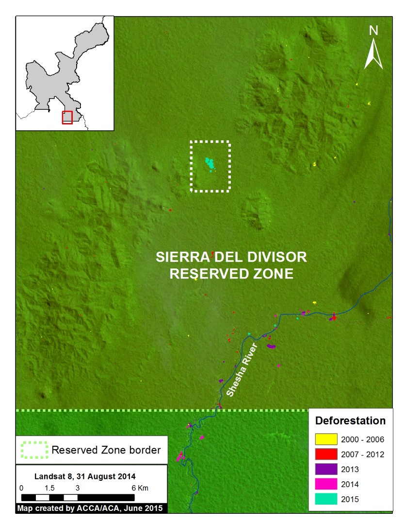
New deforestation into restricted area of Sierra del Divisor, Peru
Recently were detected new deforested areas during June within the protected area. According to experts, the cause could be attributed to the opening of areas for coca farms of illegal loggers
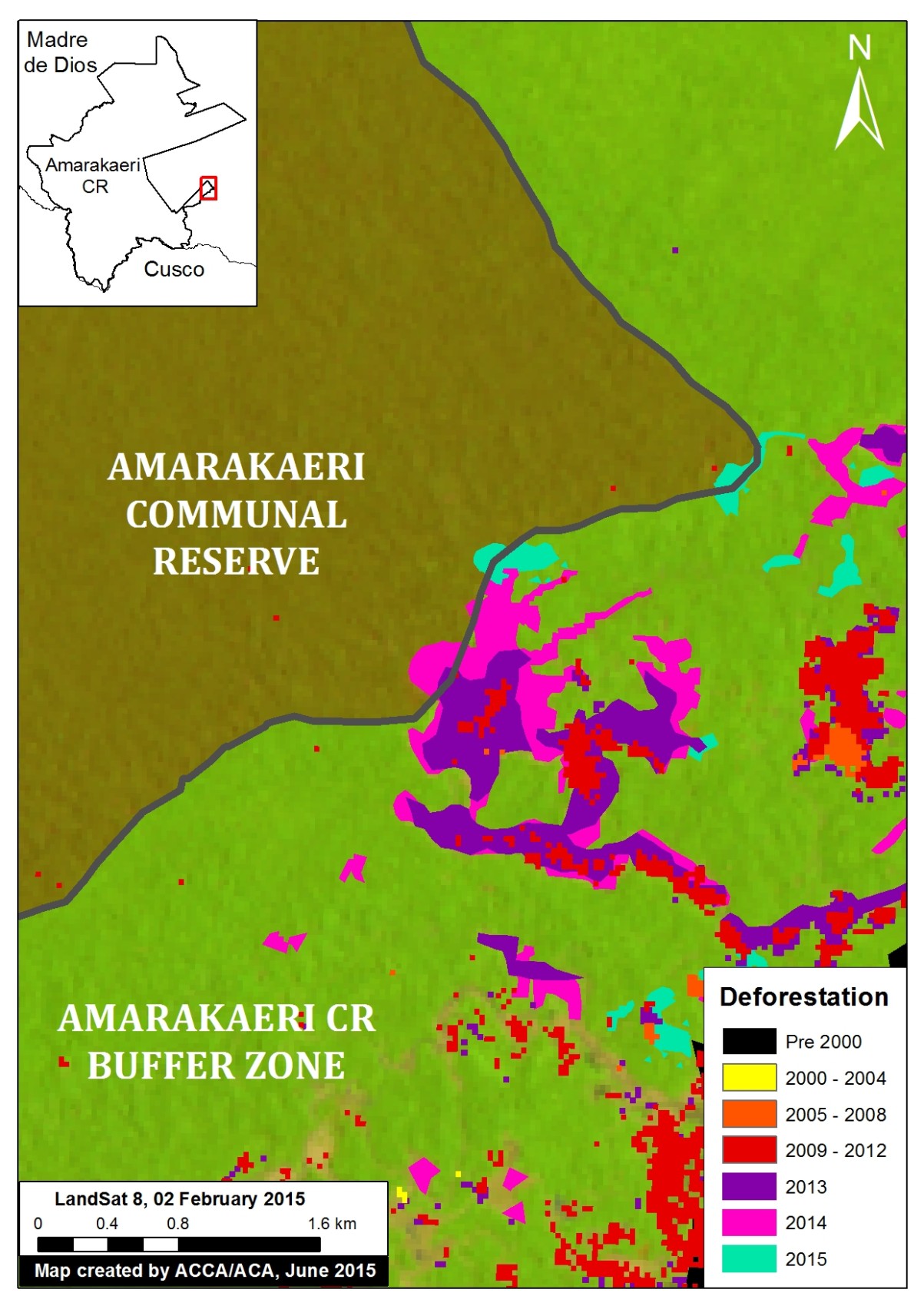
Peru: Deforestation by gold mining expands into Communal Reserve
According MAAP, deforestation reached the southeastern sector of the Amarakaeri Communal Reserve during 2013 and continued to expand between 2014 and 2015. An analysis revealed that the causative factor of deforestation was gold mining.
Deforestation by gold mining intensifies in Malinowski River, Peru
Image examines the area immediately at West of La Pampa Alto along the Malinowski River, where were documented more than 850 hectares of additional deforestation generated by gold mining between 2013 and 2015.
Palm oil plantation causes deforestation in New Requena, Peruvian Amazon
Oil palm plantations on a large scale started in 2011 near the town of Nueva Requena, Ucayali region, today cover almost 12,200 hectares.
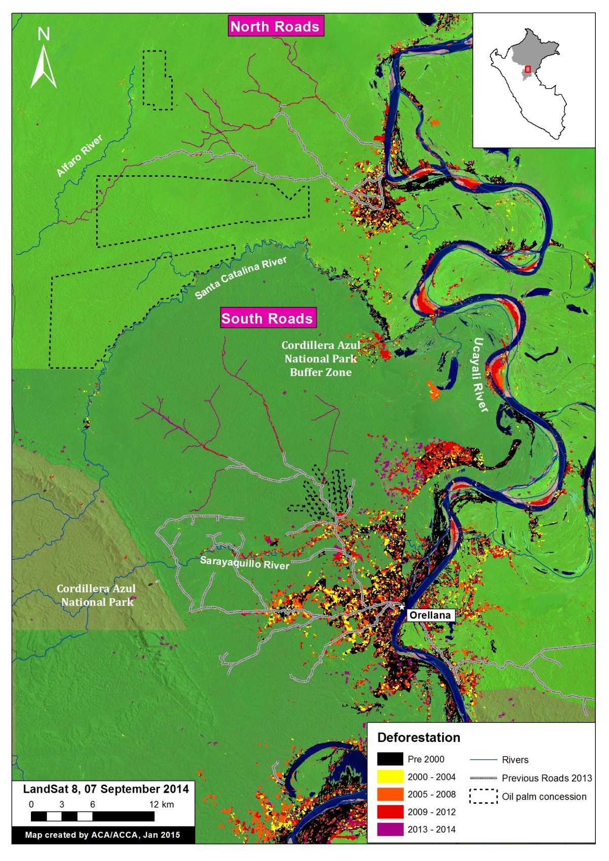
Detection of new roads (to cut forest?) in the Peruvian Amazon
Satellite images include the construction of almost 150 km of roads, possibly to extraction of illegal timber from protected areas in Peru.
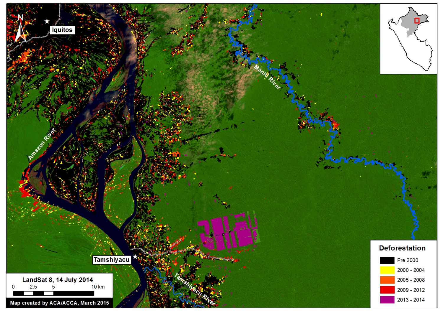
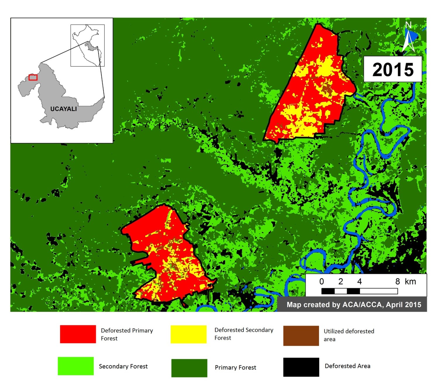
Deforestation by cocoa and oil palm in Tamshiyacu, Peru
Cocoa plantations near Tamshiyacu, northeastern Peru, devastated more than 2,100 hectares of forest between May 2013 and August 2014 in an area called Fundo Tamshiyacu