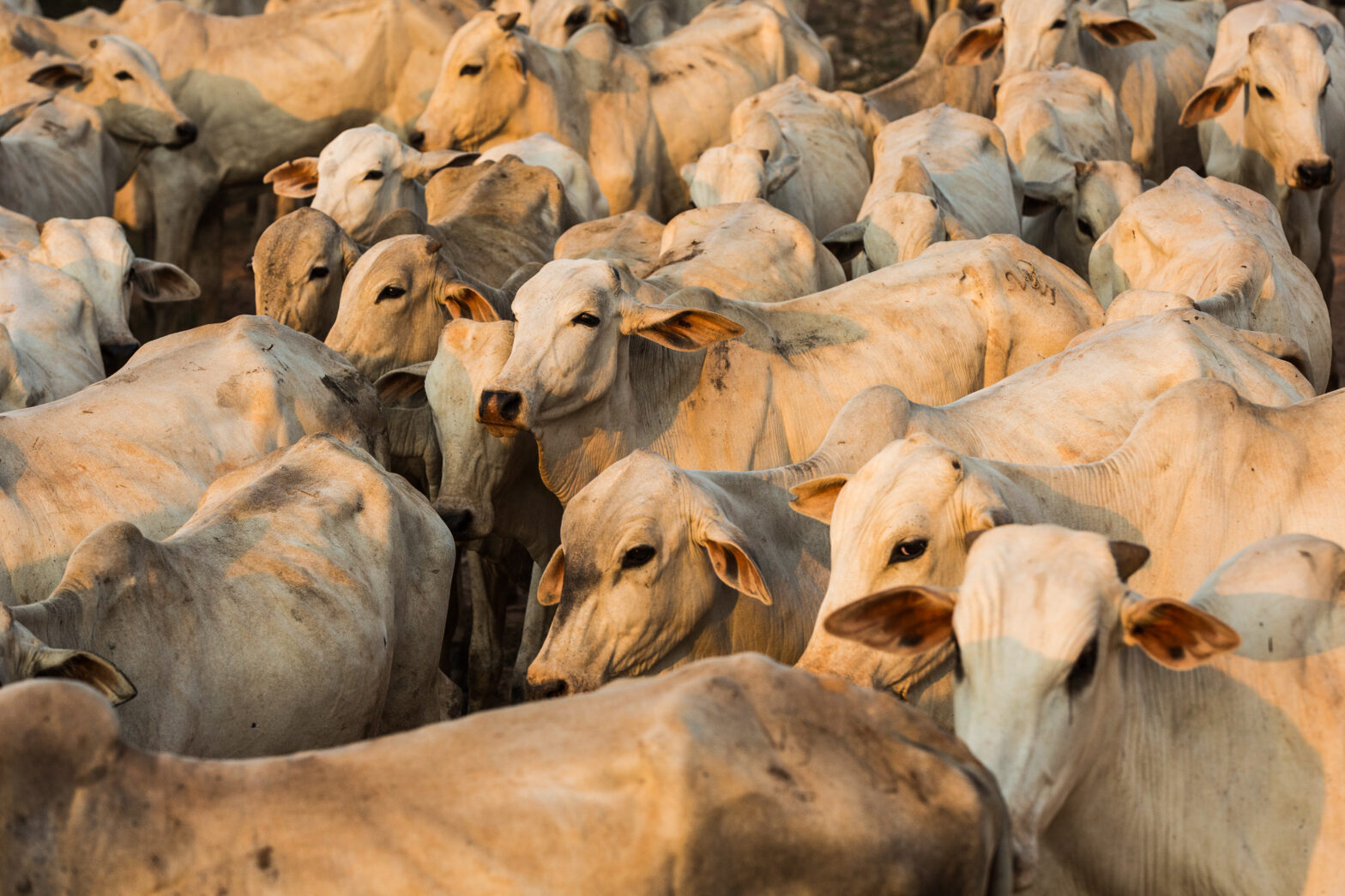
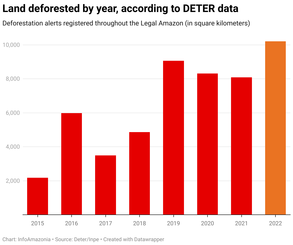
Not only were INPE’s DETER deforestation alerts in 2022 the highest in history, they surpassed the average for the previous 12 months by 25%. The state of Amazonas ranked second among those Brazilian states inside the Legal Amazon that lost the most rainforest.
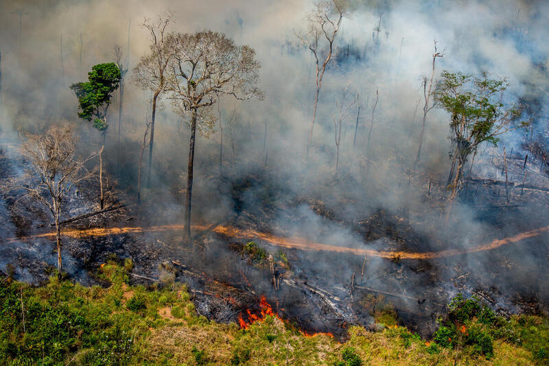
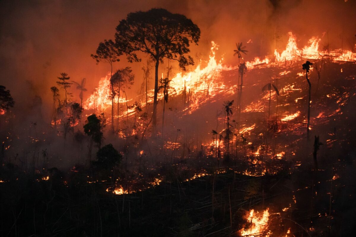
The escalation of deforestation: Complete removal of the native vegetation in a land area, normally followed by occupation with another type of vegetation or land use in Amazonia over the last four years presents a series of challenges to the Lula administration in terms of its plans to eliminate the problem by 2030—not only because of the extent of the devastation, but also because it has become more difficult to fight. The systematic dismantling of environmental policies coupled with affirmative messages emitted by the Bolsonaro administration to those seeking to use Amazonia illegally led not only to a sense of impunity but also to a rise in criminal activities.
There are many signs pointing this situation. From January-December 2022, the deforestation alerts emitted by the National Space Research Institute (INPE) DETER system: a system used by the federal government to emit quick alerts when changes of forest groundcover are detected in the Amazonia and Cerrado biomes were not only the highest in number for the historical series beginning in August of 2015, but they also exceeded the average for the 12-month period by 25% – which was already inflated by the increase of devastation in the three previous years.
The average rate of deforestation indicated by the DETER alerts between 2016-2018 was 4,844 km² per year. Between 2019 (Bolsonaro’s first year in office) and 2021, the average was 8,604 km², followed by 10,278 km² of clearcutting in 2022 alone—an area nearly seven times the size of São Paulo city. To give an idea of the size of the problem, the PlenaMata Cut Tree Counter: A tool developed by MapBiomas/PlenaMata that estimates in real time how many trees are being cut down in the Brazilian Legal Amazon logged 580 million logged trees in the year, an average of 224,823 trees every day.
“The first priority is working to change the perception of impunity. Because what fuels deforestation is impunity,” says forestry engineer Tasso Azevedo, coordinator of the MapBiomas network: a project developed by a network of universities, NGOs and IT companies to map land use in Brazil annually and monitor changes in the national territory and member of the new administration’s transition team in the new Environment work group.
The first priority is working to change the perception of impunity. Because what fuels deforestation is impunity.
Tasso Azevedo, coordinator of the MapBiomas network
Given the high rates, Azevedo is calling for immediate actions that can be carried out without extensive effort and from a distance, based on existing data, such as the so-called remote embargo. This a means for charging people with deforestation by crossing satellite imagery with data from the CAR (Rural Environmental Registry) system: A compulsory, self-declared electronic registry intended to help with environmental regularization of rural properties throughout Brazil. The property owner receives a fine in the mail and the land is automatically embargoed, meaning the owner is blocked from getting any rural credit from banks. It is considered an efficient strategy for preventing crime, but was practically ignored over the last four years.
“This measure can now be adopted on a very broad scale, which would impede people from being able to sell products, to receive financing, or regularize their property,” he explains.
The idea is to punish those who have cut down the forest and also to interfere with financing sources for new deforestation projects. “It is a mechanism for digitally freezing the property so it can’t be put to economic use. In this scenario, there is no benefit to cutting down the forest,” he says.
Accelerated clear cutting in the second semester
The first three years of the Bolsonaro administration were years of explosive deforestation. The official annual rate measured by INPE’s PRODES system: A project to officially map the annual loss of native vegetation in the Legal Amazon jumped from 7,536 km² in 2018—Michel Temer’s last year as president—to 13,038 km² in 2021, a jump of 73%.
The data, which is gathered from August 1 through July 31 of the following year—the so-called reference year for deforestation—rose during four consecutive years until there was a small reversal last year: from August, 2021-July 2022, PRODES showed an 11% drop.
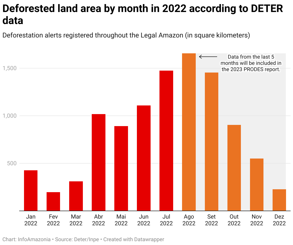
But this slight improvement does not mean relief—over 11,500 km² of forest were razed during those months. And as soon as the numbers were run, deforestation rates began to increase again. While PRODES registers the loss of vegetation over the year, INPE’s DETER is a more agile system because it can show, almost in real time, where cutting may be occurring so that inspections can be directed accordingly. The DETER alerts are the ones that exposed the acceleration in the second half of last year.
With the elections coming up and expectations that controls on deforestation could be reinstated by the Lula administration, many hurried to cut down their trees before the turnover of power. In the last five months of the year alone, 4,803 km² were cut according to DETER alerts—another record for the period since 2015.
This loss will only be considered by the next PRODES monitoring analysis concluded in July this year. In other words, the first numbers on deforestation to come out under Lula’s administration will be a Trojan Horse left by the “free-for-all” policy during the Bolsonaro years.
Aside from the bad numbers inherited by the new administration, the DETER data also reinforce some information that had shown up in recent PRODES reports and which will most likely guide the Lula administration’s actions to fight the devastation.
The municipalities of Apuí and Lábrea in southern Amazonas State lead the list of the municipalities with the highest number of DETER deforestation alerts over the year. Between the two, a total of 1,230 km² were lost, representing 11.6% of all the forest cut down inside the Legal Amazon. It is the region in which deforestation spread the most over the last two years.
Amazonas in the lead
The last two sets of data from PRODES had already shown that, for the first time since monitoring began, Amazonas was the state that lost the most forest within the Legal Amazon.
The state, which had historically held fourth place in the ranking, moved up to third in 2019 and second in 2021. The advance of the agricultural frontier in the region known as AMACRO (which includes southern Amazonas and parts of Acre and Rondônia) and real estate speculation spurred by expectations that the highway BR-319 connecting Porto Velho (RO) with Manaus (AM) will be paved are the main causes.
Notably, DETER’s fourth and seventh most deforested municipalities over the year-long period (Porto Velho with 462 km² and Nova Aripuanã with 285 km²) are located in this region. Deforestation in Amazonas was mostly carried out on unallocated public land and rural settlements. The regional changes put at risk an area that, during years of clear cutting in the Amazon, had remained a little more protected.
“This region, which had been mostly preserved until the decade starting in 2010, has fallen under the control of organized land-grabbers, who occupy unallocated public lands completely unprotected by governmental controls. If this process in which AMACRO is being occupied is not immediately contained through strong command and control tactics, a significant part of Amazonia will be destroyed,” wrote INPE researcher Gilberto Câmara, director of the Institute from 2005-2012, in an article published at the end of last year.
This region, which had been mostly preserved until the decade starting in 2010, has fallen under the control of organized land-grabbers, who occupy unallocated public lands completely unprotected by governmental controls.
Gilberto Câmara, INPE researcher
The DETER data also highlighted the spread of deforestation near BR-163 in southern Pará and along the Trans-Amazonian highway. The data are alarming not because they evidence something new, but rather because they show how organized crime has established itself in the region.
Over the last four years, there were many reports of increased illegal gold mining, logging, land grabbing as well as physical attacks on IBAMA and ICMBio inspectors, equipment and headquarters between Itaituba and Novo Progresso, which both lie along BR-163. Novo Progresso was the Amazonian city in which Jair Bolsonaro received the most votes in the primary election and also the place where his supporters attacked Federal Highway Police vehicles with stones and bullets after the general election.
This is also the region in which the largest deforested areas inside Amazonian Conservation Units were identified during 2022 according to DETER: inside the Tapajós Environmentally Protected Area and the Jamanxim National Forest.
Of the 101.29 km² of razed forest inside the EPA, 97.68 km² were located inside the municipality of Itaituba. And this is just 40% of the entire area deforested within the municipality in 2022. Meanwhile, the National Forest’s loss—the second largest identified inside Conservation Units that year, (with 88.97 km²) happened entirely inside Novo Progresso, and amounted to 39% of that city’s total deforestation. The two cities ranked 9th and 10th most deforested in the year, respectively.
First measures and new challenges
On his first day in office, Lula revived the Action Plan for the Prevention and Control of Deforestation in the Legal Amazon (PPCDAm) [A plan created in 2004 to reduce deforestation and greenhouse gas emissions generated by the loss of native vegetation in the Legal Amazon], which had been discontinued under the Bolsonaro administration. The PPCDAm was the main instrument, created by Marina Silva’s team during Lula’s first term as president, that leveraged actions leading to an 83% drop in deforestation between 2004 and 2012.
But according to specialists, this was just the first step of many that must be coordinated because the 2023 scenario is much more challenging than the one Lula dealt with in 2003.
Policies that worked before must be reinstated, and new processes that didn’t work in the past must be improved upon, like real support for sustainable development in the region through the creation of economic alternatives to pillaging the forest.
“The large and medium-scale deforesters will have to be dealt with through recuperated policies that worked before, with the awareness that today we have more challenges. Amazonia is more violent because these guys were basically empowered by Bolsonaro. On January 8 [when vandals and supposed coup plotters invaded the headquarters of democracy in Brasilia], we witnessed acts that quite imaginably could occur on the frontiers of Amazonia when the environmental crime operations begin,” affirms Imazon researcher Paulo Barreto, who investigates deforestation dynamics.
Amazonia is more violent because these guys were basically empowered by Bolsonaro. On January 8, we witnessed acts that quite imaginably could occur on the frontiers of Amazonia when the environmental crime operations begin.
Paulo Barreto, Imazon researcher
“A key point is to trace the money coming from illegal mining, logging and land grabbing. Before much can be done on the operational end, much can be done by interfering in the process through financially intelligent actions and other information bases: to block, confiscate, and bring in more intelligence and investigation,” says Barreto.
“There’s been much deforestation in recent years. And this is the type of crime in which the body always remains at the scene of the crime. No more trees need to be killed in order to start investigating. There is a very long list of cases in which no one has been charged. The government doesn’t need to wait for a new wave of deforestation to start taking action,” he states.
An article published at the end of last year by Gilberto Câmara and his colleagues at INPE outlines some other characteristics of the deforestation seen in recent years. The study looks at the devastation registered by PRODES between 2008 and 2021 (August 2008-July 2021)—in other words, it does not include what happened over the last year—but it shows recent changes in behavior that will have to be in the sights of inspectors.
The study led by Câmara and published in CEBRI magazine (from the Brazilian Center of International Relations) discusses the challenges ahead if Brazil is to reach the commitment it made in the Paris Accord: zero illegal deforestation by 2030.
According to the authors, deforestation on unallocated public lands increased from 12% in 2008 to 20% in 2021. “This latest increase is a critical sign that the land frontier is spreading into new areas outside the traditional ‘deforestation arch’” they say.
According to the authors, there has also been a change in the profile of deforestation on private property. “Between 2008 and 2012, when the government was taking strong action, around 1% of the properties carried out 75% of the clear cutting. In the period between 2018-2021, when law enforcement was greatly reduced, about 0.5% of the properties were 75% of the cutting. In other words, in recent years, only 2,500 properties and rural settlements out of the total 500,000 are cutting most of the trees.”
The problem is even more concentrated when titled properties are analyzed. According to the study, 1% of the titled land in Amazonia was responsible for 83% of the deforestation on rural properties (registered in the CAR Rural Registry system) in 2021.
“So we have a strong concentration of perpetrators associated with large deforested areas. This suggests that direct control tactics could work well to prevent illegal deforestation,” state the researchers.