

Defending the jungles, mountains, forests and rivers of Latin America has never been this dangerous. Six of the ten most hostile countries for leaders and communities defending the environment and their ancestral lands are located in Latin America, according to UN Special Rapporteur Michel Forst’s 2016 report to United Nations. This is why 30 journalists, […]
News
Posted inBrazil
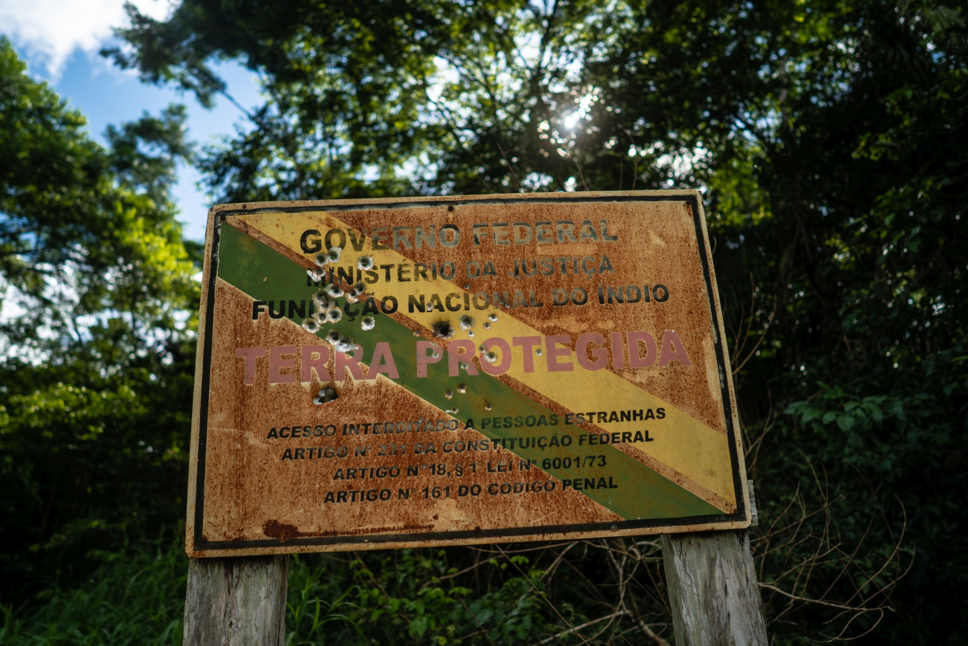
Indigenous communities under siege in Rondon’s land
The invasions of indigenous territories in Rondonia are not something new. But data on episodes of violence in the countryside, such as assassinations of leaders and threats to communities, reveal the resurgence of this fight.
Posted inHydroelectric Power
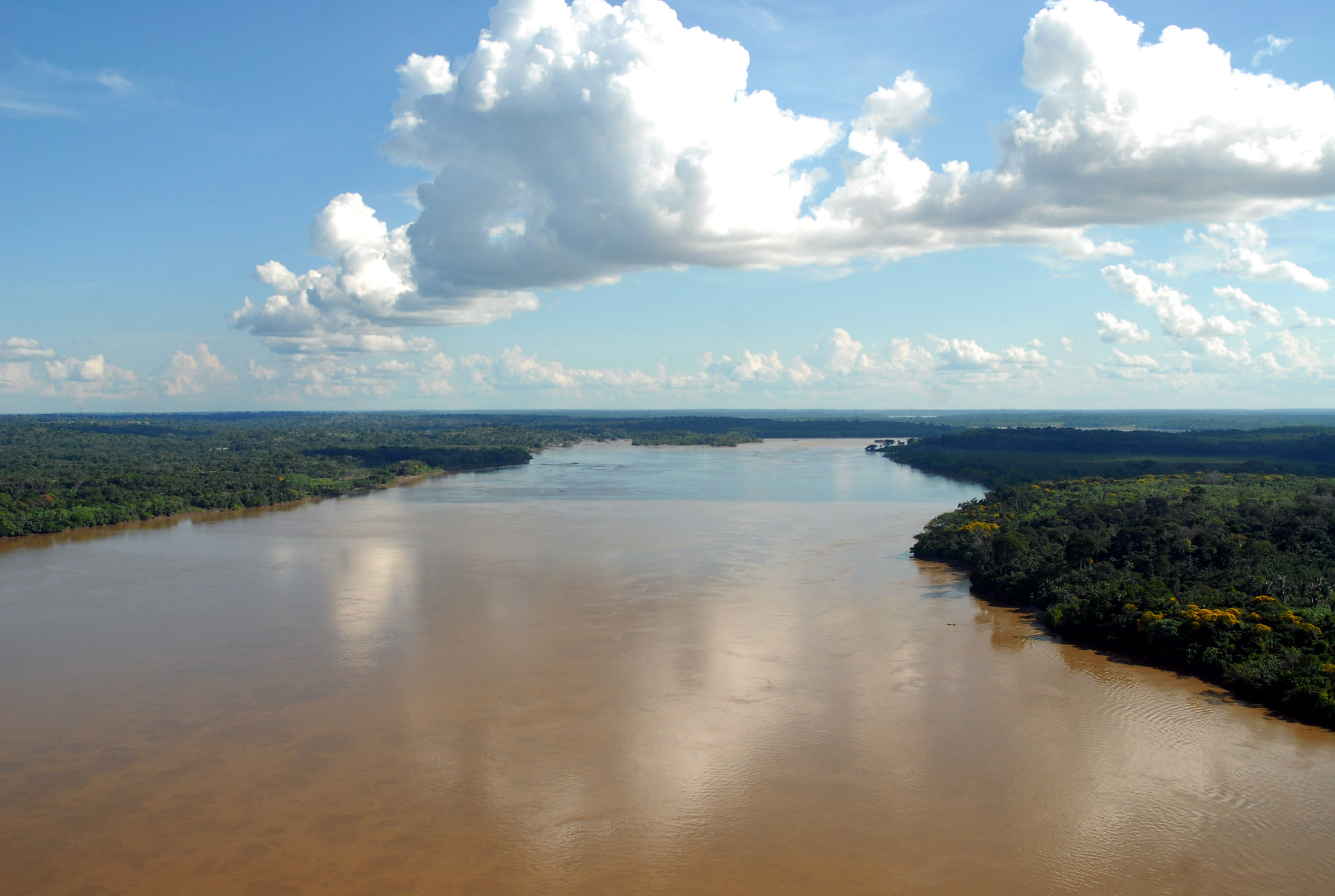
Madeira River dams may spell doom for Amazon’s marathon catfish: Studies
[:pt]O monitoramento independente de uma população de grandes bagres no rio Madeira, importante afluente do Amazonas, confirma que duas usinas hidrelétricas praticamente impediram a migração da espécie que faz a mais longa migração de água doce conhecida no mundo
Posted invideo / Biodiversity
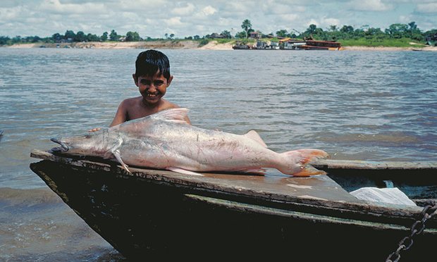
Extraordinary migration of giant Amazon catfish revealed
The dorado catfish, which can grow up to 2 metres long, is an important source of food for people along the world’s longest river. It was suspected of making a spectacular journey, but a careful new analysis of the distribution of larvae and juvenile and mature adults has confirmed the mammoth migration.
Posted in
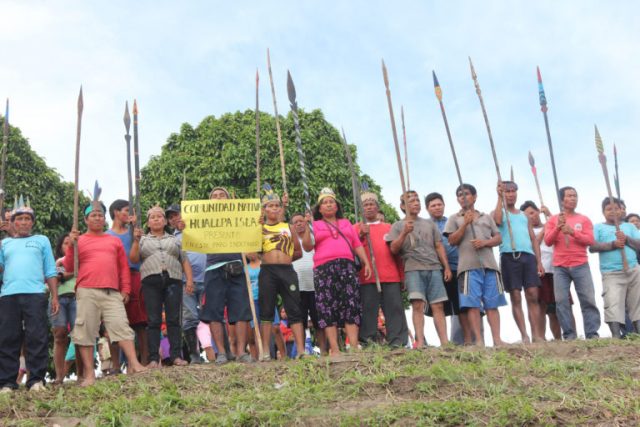
New talks on oil pollution could end indigenous blockade of Amazonian river in Peru
An indigenous protest over oil pollution in the Peruvian Amazon — which is blocking boat traffic on the Marañón River, a crucial transportation route — could move toward a solution in the coming days, with a meeting between protesters and Cabinet ministers.
Posted in
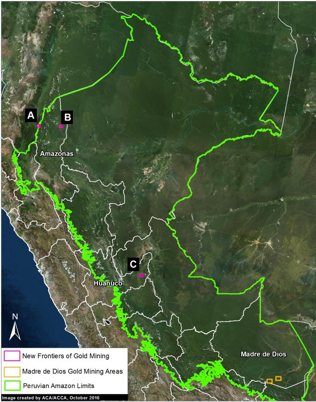
New frontier of gold mining in the Peruvian Amazon
In the current report, we show the new gold mining frontiers in northern and central Peru: two cases in the region of Amazonas and a case in the buffer zone of El Sira Communal Reserve, in the Huanuco region.
Posted in
Environmental official murdered in Brazilian Amazon
Luiz Alberto Araújo, 54 years old, who headed the environment department for the municipal government of the town of Altamira in the Amazonian state of Pará, was killed by two gunmen
Posted in
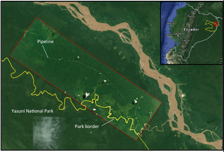
Exclusive: new satellite images show oil drilling in Yasuni-ITT
Mongabay has obtained a new, high-resolution satellite image of Petroamazona’s suspected pipeline and drilling platforms in the famed Ishpingo-Tambococha-Tiputini (ITT) block. Obtained from Planet, the image was analyzed by the team at the Monitoring of the Andean Amazon Project (MAAP) just after Ecuador announced it had begun drilling in arguably the most biodiverse place on the planet.
Posted in
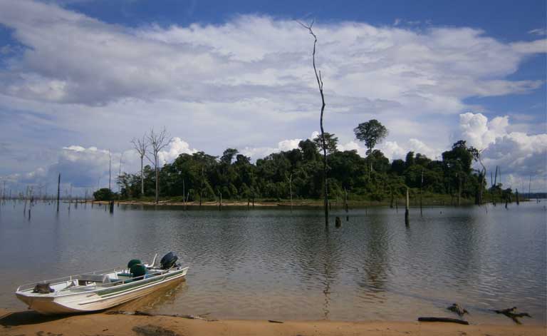
Dams inevitably result in species decline, losses on reservoir islands
Global dam study: reservoir islands shouldn’t be counted as conservation areas by developers. Island isolation inevitably leads to extinctions, ecosystem instability. by Claire Salisbury Hydropower development is booming, with controversial projects unfolding across the Americas, Africa, Asia and Europe. Though often presented as a green renewable energy option, dams can cause a litany of negative […]