
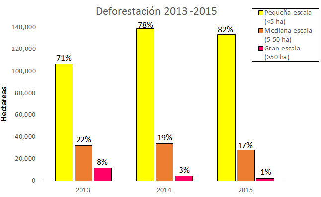
Previously we presented maps of deforestation hotspots in the Peruvian Amazon for the periods 2012-2014 and 2015, respectively. In this MAAP we present a complementary analysis based on the size of the deforestation events.
There are no comments yet. Leave a comment!
Related Posts
Map of deforestation hotspots in the Peruvian Amazon, 2012-2014
March 1, 2016
Deforestation continues to increase in the Peruvian Amazon. According to the latest information from the Peruvian Environment Ministry, 2014 had the highest annual forest loss on record since 2000.
Deforestation in the Amazon: past, present and future
March 21, 2023
According to a new study from RAISG, in just five years, the Amazon could lose almost half of what it lost in the past two decades.
Gold mining ramps up, pushes deeper into Peruvian reserve
April 29, 2016
New data indicate a big surge in gold mining in and near Tambopata National Reserve over the past few months.