
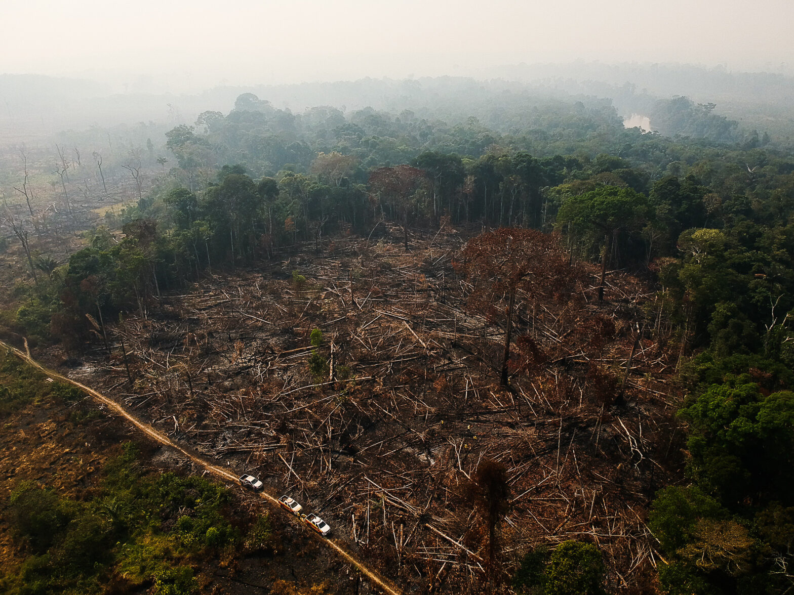
Deter’s alerts recorded the largest deforestation in the forest since 2016. The destruction was concentrated in the states of Mato Grosso, Roraima, and Pará and advanced on areas in southern Amazonas and in the region around the BR-319 highway. Deforestation is fueled by a lack of oversight and is expected to grow this year.
The chainsaws were not switched off even during the rains in the Amazon, and the alerts generated by the Deter program of the National Institute for Space Research (Inpe) totaled 430 km² in January, the largest loss in the same month since 2016, the beginning of the historical series. It is 51% higher than the second-highest rate recorded on January 2020, 284 km².
Experts connect the explosion in deforestation to a sharp rise in uncontrolled crime. This year will probably have a new annual record of losses.
The official satellite monitoring system shows that the main type of deforestation was with “exposed soil”, in which vegetation is completely cleared to implement pastures and crops. The destruction was concentrated in Mato Grosso, Rondônia, and Pará. Among the municipalities with the most deforestation in January are Porto Velho (RO), Rorainópolis (RO), Marcelândia (MT), Colniza (MT), São Félix do Xingu (PA), Altamira (PA), and Lábrea (AM), among others.
The INPE maps show that the destruction continues to advance from the “arc of deforestation” to previously untouched areas of the forest, such as southern Amazonas. Landgrabbers concentrate their actions in public lands. Paulo Moutinho, the senior scientist at the Amazon Environmental Research Institute (Ipam), believes the increase in deforestation is due to the dismantling of environmental inspection, at all levels from federal to municipal, and the advance of international organized crime in parts of the rainforest.
“Rains won’t stop the land-grabbers, and weakened inspection agencies cannot act, especially where access is difficult. Criminals have more money and equipment to deforest through collusion with drug and weapons trafficking. There is a race for illegal possession of public lands,” reported the doctor in Ecology.

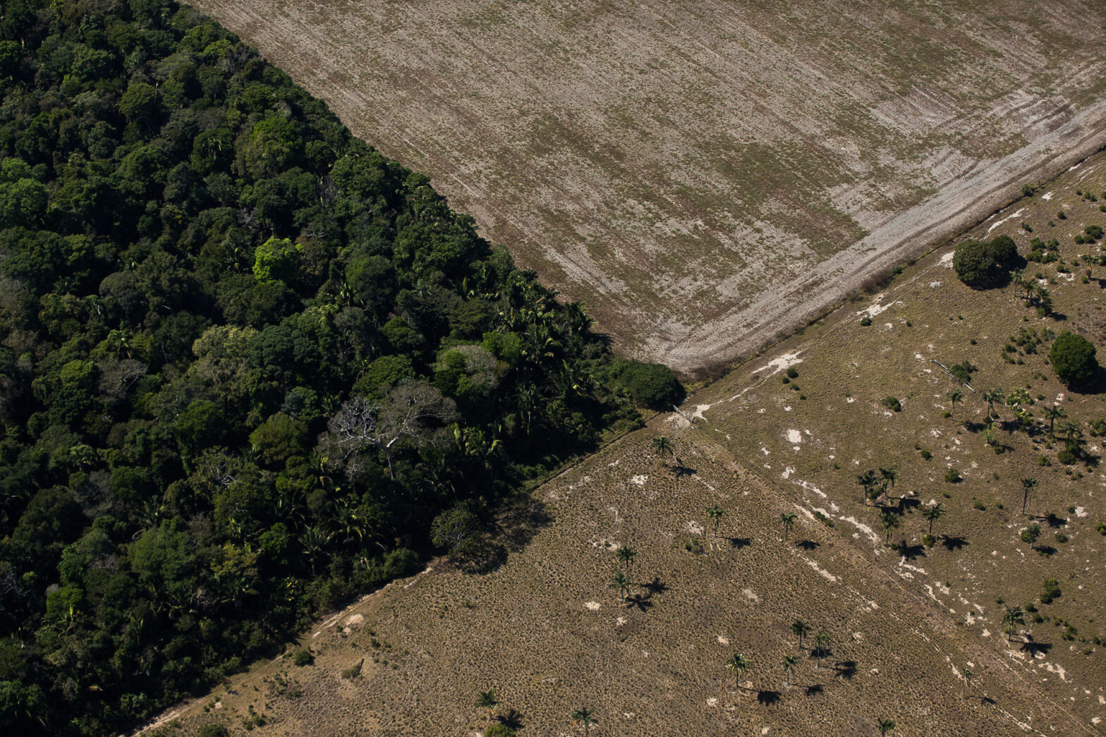
A report by the Amazon 2030 initiative, published this week, revealed that half of the deforestation in the Amazon over the last three years happened in undesignated (30%) or allocated (21%) public lands, such as indigenous lands, national and state parks, and other conservation units.
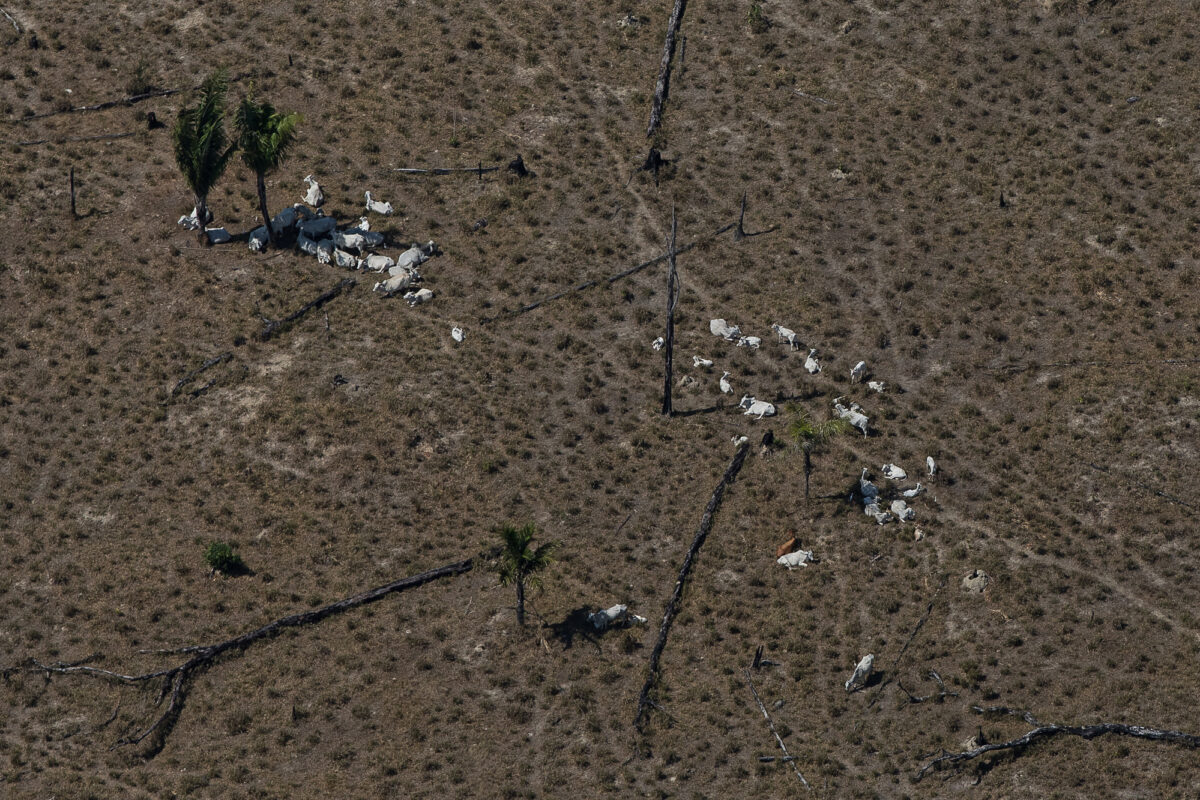
The document detailed that 75% of illegally occupied and deforested public territories are transformed into cattle pastures – 20% of them are abandoned after criminal actions. Public forests without regular or officially protected use total 565,000 km² in the country, equivalent to the area of the state of Bahia.
“Animal agriculture is the easiest way to achieve an ‘illusion of legality’ for criminal deforestation. Someone buys cattle and leaves them in these areas for a few years. Meat prices stimulate animal agriculture in the Amazon. Forming pastures in the forest is expensive, up to R$2,000 per hectare. Small land grabbers can’t afford it,” highlighted Ipam’s Moutinho.
Rains won’t stop the land-grabbers, and weakened inspection agencies cannot act, especially where access is difficult. Criminals have more money and equipment to deforest through collusion with drug and weapons trafficking. There is a race for illegal possession of public lands.
Paulo Moutinho, Ipam’s researcher
As shown by InfoAmazonia and PlenaMata, land grabbing and deforestation are advancing further in western Amazonia, especially in the region known as Amacro, and in southern Amazonas. Throughout 2021 and in January this year it was no different, according to an analysis by the Institute for Conservation and Sustainable Development of the Amazon (Idesam).
The study reveals an uptick in deforestation and forest fires in the BR-319 region. The greatest losses were in municipalities in Rondônia, such as Porto Velho, and Amazonas, such as Lábrea, Humaitá, Canutama, and Tapauá. In the Amazon, deforestation grew 48%, from 1,395 km² (2020) to 2,071 km² (2021), according to data from the Deforestation Alert System (SAD) of the Amazon Institute of Man and Environment (Imazon), which also monitors the region through satellite images.
2021 had the highest number of hot spots in municipalities in the BR-319 region since 2010. Last year, 10% (10,622) of the hotspots recorded in the entire Legal Amazon (102,213) were in those locations, according to monitoring by Inpe’s Queimadas Program. Porto Velho, in Rondônia, and Lábrea, Canutama, and Manicoré, in Amazonas, were among the ones that most burn the forest in that [art of the Amazon.
“Announcements that construction of the BR-319 will be completed this year have heated land grabbing and deforestation in the region. Legal relaxations, amnesties to crimes, and the dismantling of environmental agencies all feed into a ‘snowball’ of crimes, such as the occupation and sale of lots around the highway,” said Fernanda Meirelles, the executive secretary of the BR-319 Observatory.
Licensing and construction of the highway advance with federal resources from the National Department of Transport Infrastructure (DNIT) and the Ministry of Infrastructure. The Jair Bolsonaro government hopes to complete them this year and reap political-electoral dividends in the Amazon. The contract does not stipulate a plan to stop deforestation and its licensing is flawed, says the expert.
The lack of control over crime and informal economies exhaust Brazilians’ strategic natural resources, blocks a sustainable development agenda in the Amazon, and will also swell deforestation this year.
According to PrevisIA, a tool that points to areas at higher risk of deforestation, 15,391 km² of forest may be felled between August 2021 and July 2022. This would be the largest surge in the last 16 years.
“Unfortunately, Deforestation will not stop and we will probably have more monthly records during this election year,” concluded Moutinho.
Story by InfoAmazonia for the PlenaMata project.