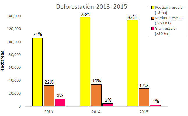
Previously we presented maps of deforestation hotspots in the Peruvian Amazon for the periods 2012-2014 and 2015, respectively. In this MAAP we present a complementary analysis based on the size of the deforestation events.
By visiting this site, you agree to the use of cookies, which are designed to improve your experience and are used for the purpose of analytics and personalization. To find out more, please read our Cookies policy. You can change the settings also.