
[aqui vai o texto da matéria sobre o mapa – versão ESPANHOL?]
A map that tweet alerts of illegal mining in Amazon forest
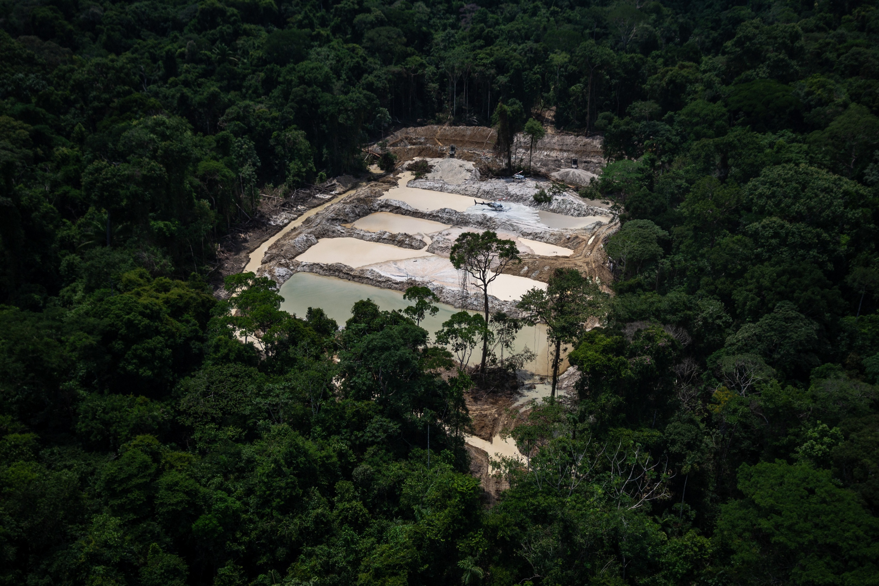
Foto de abertura: Detalhe do mapa
Author: Hyury Potter
The Brazilian Amazon lost about 410,000 km² of native forest between 2000 and 2017¹ – an area almost the size of California State. Illegal mining is one of the main factors of deforestation. The government fiscalize the area with environmental agencies such as ICMBio (Chico Mendes Institute for Conservation and Biodiversity), but the same government itself, through the National Mining Agency (ANM), allow study and mining licenses in protected areas, an illegal practice under federal law 9.985/2000².
The project aims to identify on maps and create a Twitter alert of ANM study and mining licenses in the Amazonia full protection areas, identified as class 1. Amazon has 39 protected areas of class 1 and they will appear on the project map, where no mining practice must be allowed.
This tool is especially relevant currently in Brazil because of the far-right president Jair Bolsonaro, who diminishes the importance of preserving the environment as well as data on deforestation³. The purpose of the map and the alert via Twitter is to inform the citizens and to facilitate the work of the press that follows the environment in Brazil, as well as NGOs.
The team of the site Infoamazônia4 will help with the work of elaboration and publication of the map. The journalist Gustavo Faleiros5 is the co-founder of Infoamazônia and a former fellow of ICFJ. I will use the budget for a programmer to create the map and connect it to the Twitter bot. During the eight weeks I will work providing data on mineral licenses and the rules of each one of the 39 protected areas.