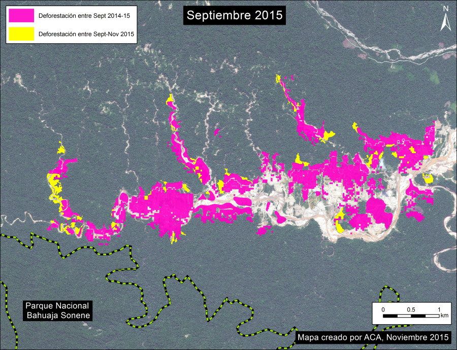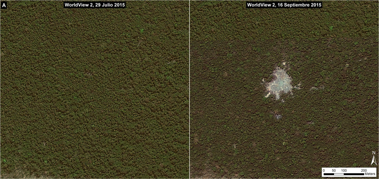
New high resolution image of La Pampa of September 16, 2015 shows the birth of a new area of illegal gold mining, with a current area of 1.5 hectares.
In MAAP #12, we featured a high resolution image from July 29, 2015 of the area known as “La Pampa,” a hotspot of illegal mining in the buffer zone of the Tambopata National Reserve (Madre de Dios region, Peru).
Just seven weeks later, we obtained a new high resolution image of La Pampa for September 16, 2015. Image 17a shows the birth of a new gold mining zone between the July image (left panel) and September image (right panel) (see the letter “A” in Image 17b for context). The current extent of this new clearing is 1.5 hectares. This mining activity is illegal since it is located within the buffer zone of the Tambopata National Reserve.

Reference Map
Image 17b is the reference map, showing the forest cover change between July (left panel) and September (right panel) 2015. In the right panel, the letter “A” corresponds to Image 17a, while the letter “B” corresponds to Image 17c.

Image 17b. Reference map. Data: WorldView Digital Globe (NextView).
Expanding Deforestation
Image 17c shows the deforestation expanding to the west between July (left panel) and September (right panel) 2015.

Image 17c. Deforestation expanding to the west between July and September 2015. Data: WorldView Digital Globe (NextView).
– This report was originally published in MAAP and is republished by an agreement to share content.