The INPE programs are vital to keep the forest standing. While Prodes generates annual deforestation rates, Deter makes daily alerts to improve monitoring against tree cutting and fires.
Created in different decades, Prodes and Deter are projects in the National Institute for Space Research (Inpe) with the goal of monitoring and controlling deforestation, degradation, fires, and other impacts on the tropical forest and other biomes. Its development and distinct uses are linked to the history and national policies of economic exploitation and conservation of nature in Brazil.
“The data from Prodes and Deter are essential to control what happens in the forest and generate environmental, social, and economic impacts, such as restricting the purchase of soybeans and other items from illegally deforested areas. They also made the Institute a global reference in surveillance of the forest and other regions,” said Luis Eduardo Maurano, manager of the Amazon satellite monitoring programs at INPE.
The systems are different, but complementary. While Prodes generates annual deforestation rates, supporting long-term public policies to contain the destruction of the Amazon and the Cerrado, Deter delivers daily alerts to streamline and qualify the inspection of environmental and police agencies in the forest. The tools use satellite images with different resolutions and processing deadlines.
Therefore, the Prodes and Deter numbers are distinct. On average, each annual Prodes deforestation rate is higher than the sum of the year’s Deter alerts, according to calculations by MapBiomas. This is mainly because of the higher resolution images of the satellites used by Prodes.
To get an idea of the difference in results, Prodes found a deforestation rate of 13,200km² between August 2020 and July 2021. During the same period, Deter’s alerts estimated deforestation to be 8,870 km², 32.8% lower.


The early days of monitoring
“The deforestation rate was not published until 1993, due to obstacles such as lack of resources in the transition between the Collor and Itamar governments. The numbers that had accumulated until 1994 were divided in half to cover the gap. Therefore, the rates are the only two that are the same in over three decades of monitoring,” said INPE researcher Maurano to InfoAmazonia and PlenaMata.
Prodes inventories on deforestation of primary forests support public policies, greenhouse gas emission estimates, and can help release international resources associated with conservation, climate, and biodiversity agendas.
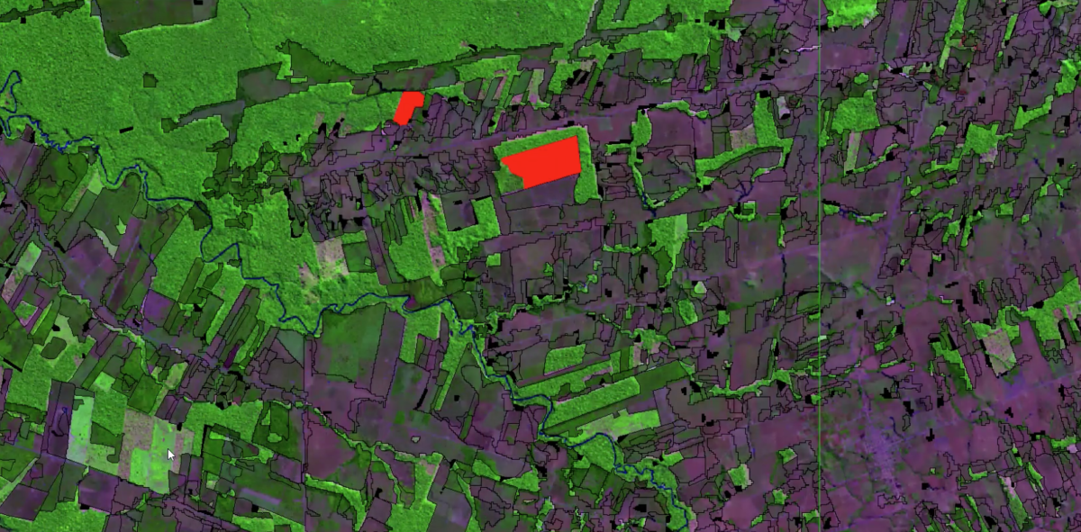
Almost all the images used in Prodes come from Landsat, a satellite owned by NASA and the United States Geological Survey, which sweeps the Amazon every 16 days with a resolution of 30 meters. Scenes from satellites such as CBERS, the result of a partnership between Brazil and China, and Sentinel, from the European Space Agency, complete information from cloudy areas that Landsat was unable to identify.
Losses are identified starting at 6.25 hectares – deforestation of smaller areas does not enter the annual rate. Internally, INPE handles images and deforestation starting at 2 hectares, but the estimates released at the end of each year, and the consolidated rates published in the following months maintain the 6.25 hectares base so as not to “contaminate” the historical series, recorded since 1988.
The annual deforestation comes from the comparison between the best images captured in the drought (July to September) of the year analyzed with the images of two or more previous years. The video below shows the entire process of analysis and validation of the deforested areas detected by Prodes.
As with Prodes, Deter analysis is also done with the TerraAmazon program. But deforestation alerts are daily, and the comparison is not made based on the images of previous years as in Prodes, but with the last available image, every 5 days.
A team of experts of approximately 10 people, based in the Inpe office in Belém (Pará), is responsible for daily visual interpretation of the satellite images that make up the scenes of the system. Four senior auditors perform daily validation of approximately 30% of the polygons generated. This validation indicates over 90% accuracy rate in the data.
2004: Deter alerts begin
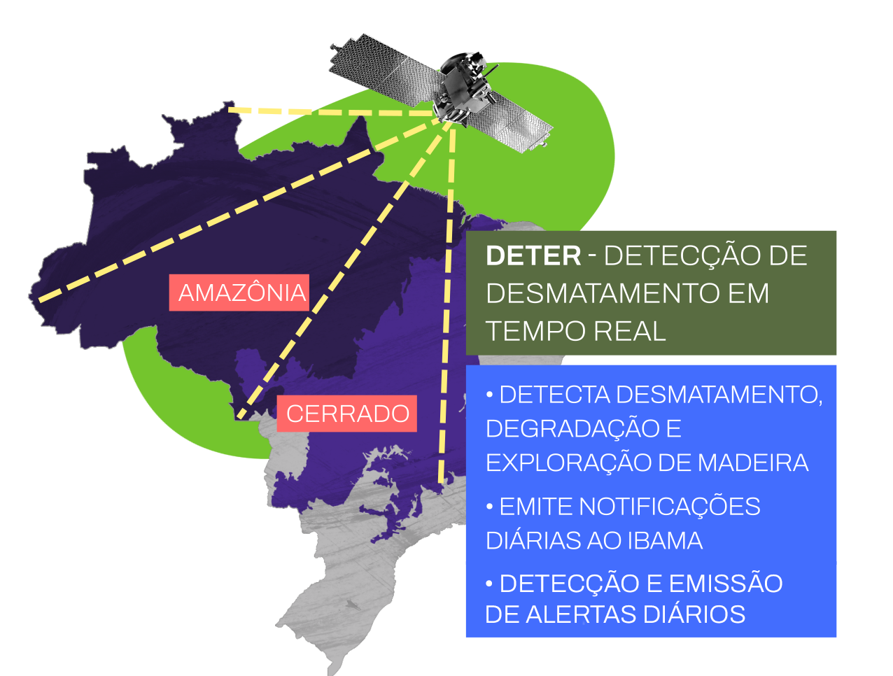
In 2004, sixteen years after Prodes was launched, the country gained a new strategic tool for actions against environmental crime, the Real-Time Deforestation Detection System, Deter.
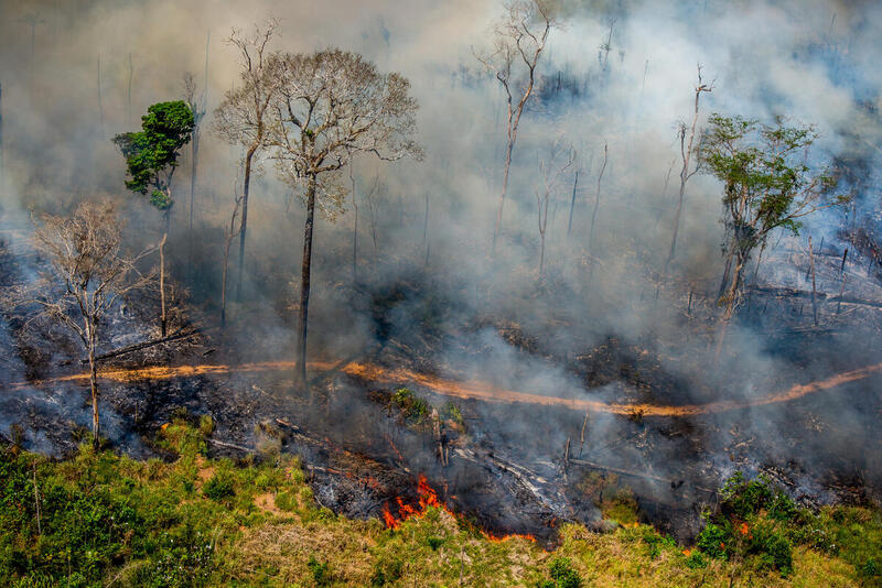
It arose after Prodes verified the second-largest deforestation rate in the Amazon in the second year of the first Lula government. Between August 2003 and July 2004, a total of 27,700 km² of the forest was felled. The overwhelming deforestation–which only lost to the 29,000 km² deforested between 1994 and 1995 – led to the creation of the Action Plan for Prevention and Control of Deforestation in the Legal Amazon (PPCDAm), which made several ministries act together and contain the destruction of the forest, as well as Deter.
The first generation Deter system functioned between 2004 and 2015. In August 2015, Deter-B came into operation, with a much higher spatial resolution. Because of this difference, the data for the two periods are not comparable, and the current Deter historical series begins in 2015.
Currently using satellite images such as CBERS and Amazon, a 100% Brazilian satellite, Deter generates daily alerts for deforestation starting at 3 hectares. These alerts are linked to selective logging, deforestation with or without exposed soil, mining and prospecting, forest degradation, and fire scars.
Warnings about deforestation are accessed directly by environmental agencies such as IBAMA and ICMBio, as well as the Public Prosecutor’s Office, so that they can plan and act promptly or strategically against logging and other environmental crimes.
“The primary function of Deter is to subsidize inspection and monitoring. It also points to declining or increasing trends in the annual deforestation figures consolidated by Prodes. The two systems have different databases and teams, but if Deter points out more critical areas for deforestation or burning, Prodes can look at them more closely,” explained Maurano, from INPE.
Prodes rates, Deter alerts, and other tools and information generated by INPE are published on the TerraBrasilis platform. All its data is public and can be downloaded and used for free. Deter’s daily data is made available to the public approximately 2 weeks after the alerts are issued.
Despite its historical role in generating data and information essential to controlling deforestation in the Amazon and other biomes, INPE ended 2021 with the lowest budget it has had in over a decade, at only R$85 million.
Prodes

Deter
Deter
– Launch: 2004, the current system (Deter-B) was launched in August 2015
– Functions: generating daily alerts to streamline and qualify the inspection of environmental and police agencies to contain the destruction of the Amazon.
– Satellites: CBERS, Amazônia Spatial resolution: 60 meters
– Losses identified starting at 3 hectares
InfoAmazonia’r special report for PlenaMata project.